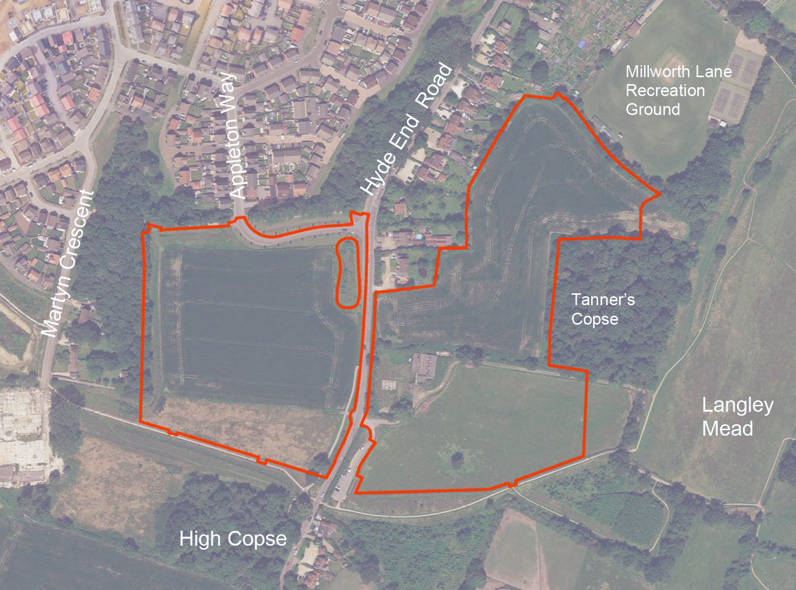
Bloor Homes Logo

Land East & West of
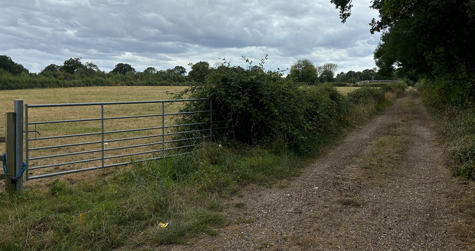
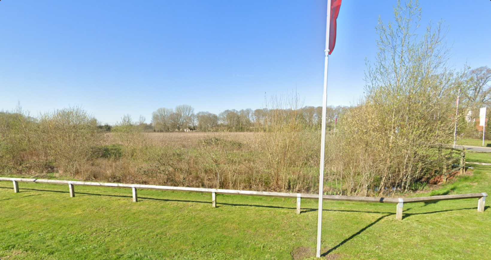
Hyde End Road, Shinfield

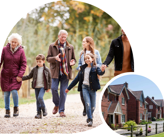
Welcome to our website, where you can discover more information about our emerging proposals for a new residential development to the south of Shinfield.

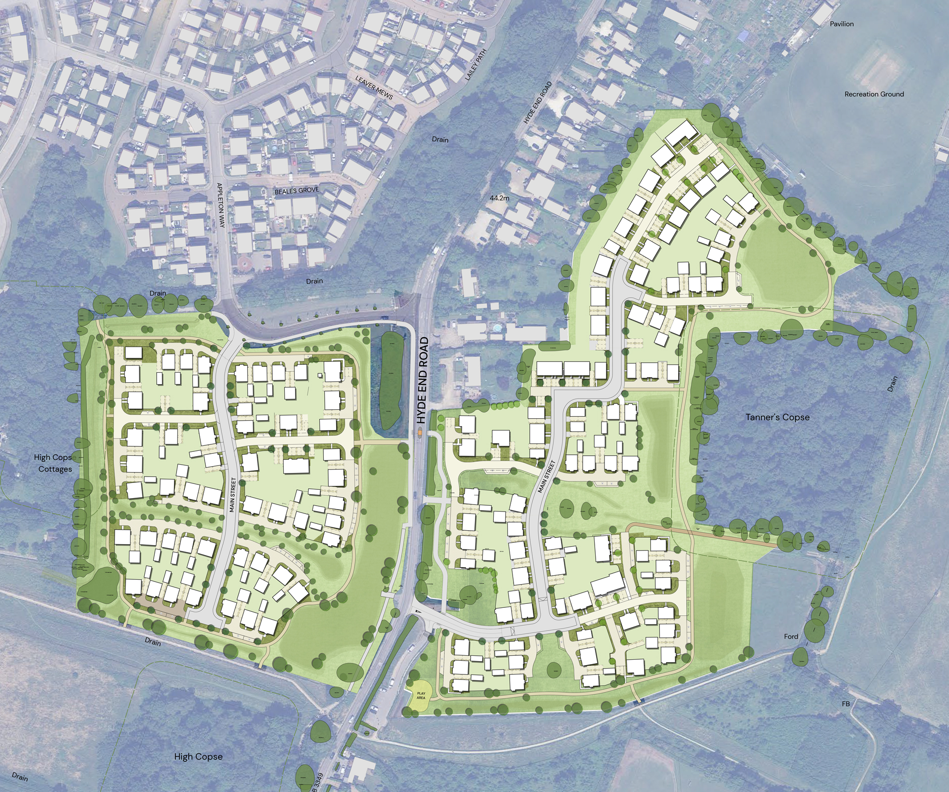
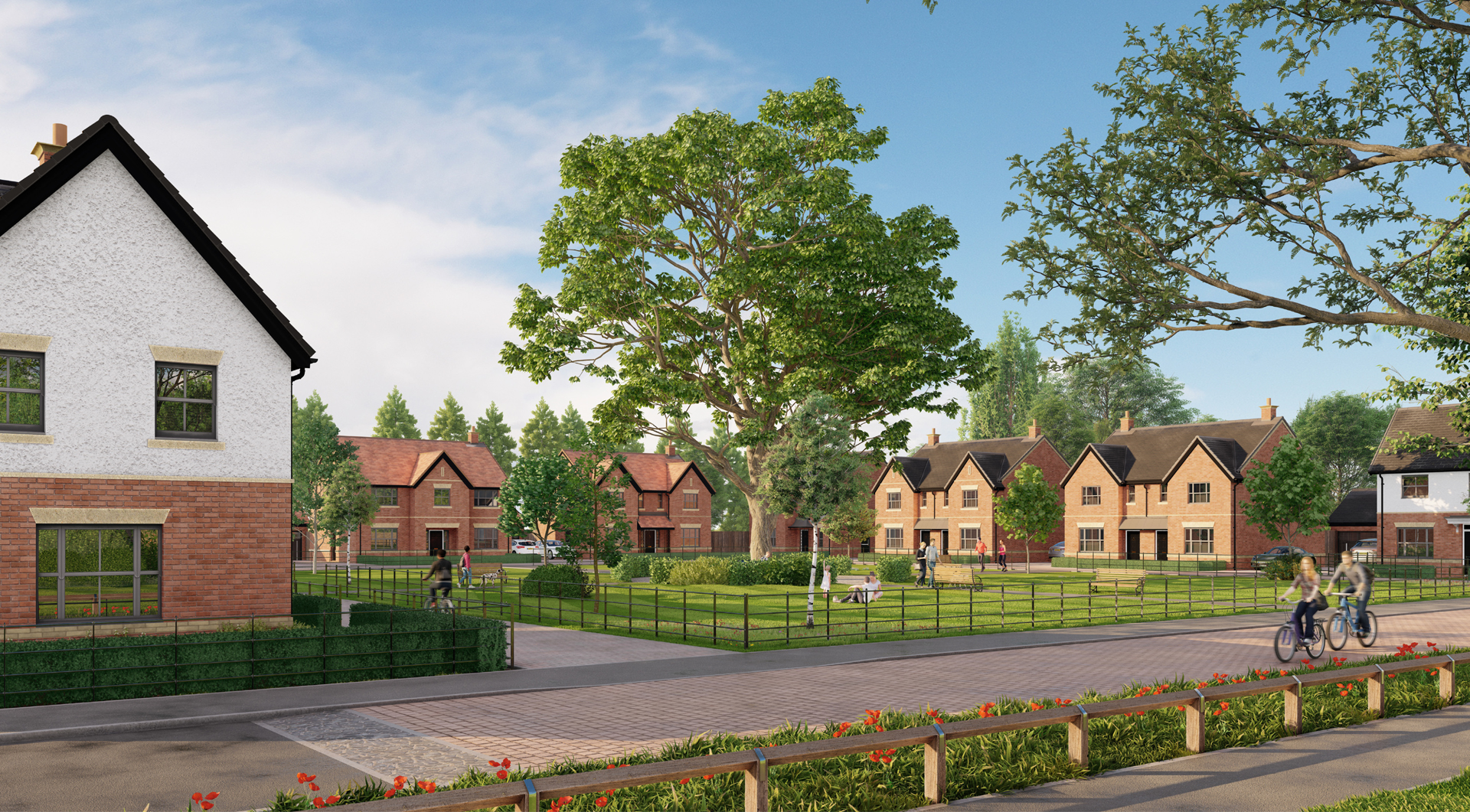
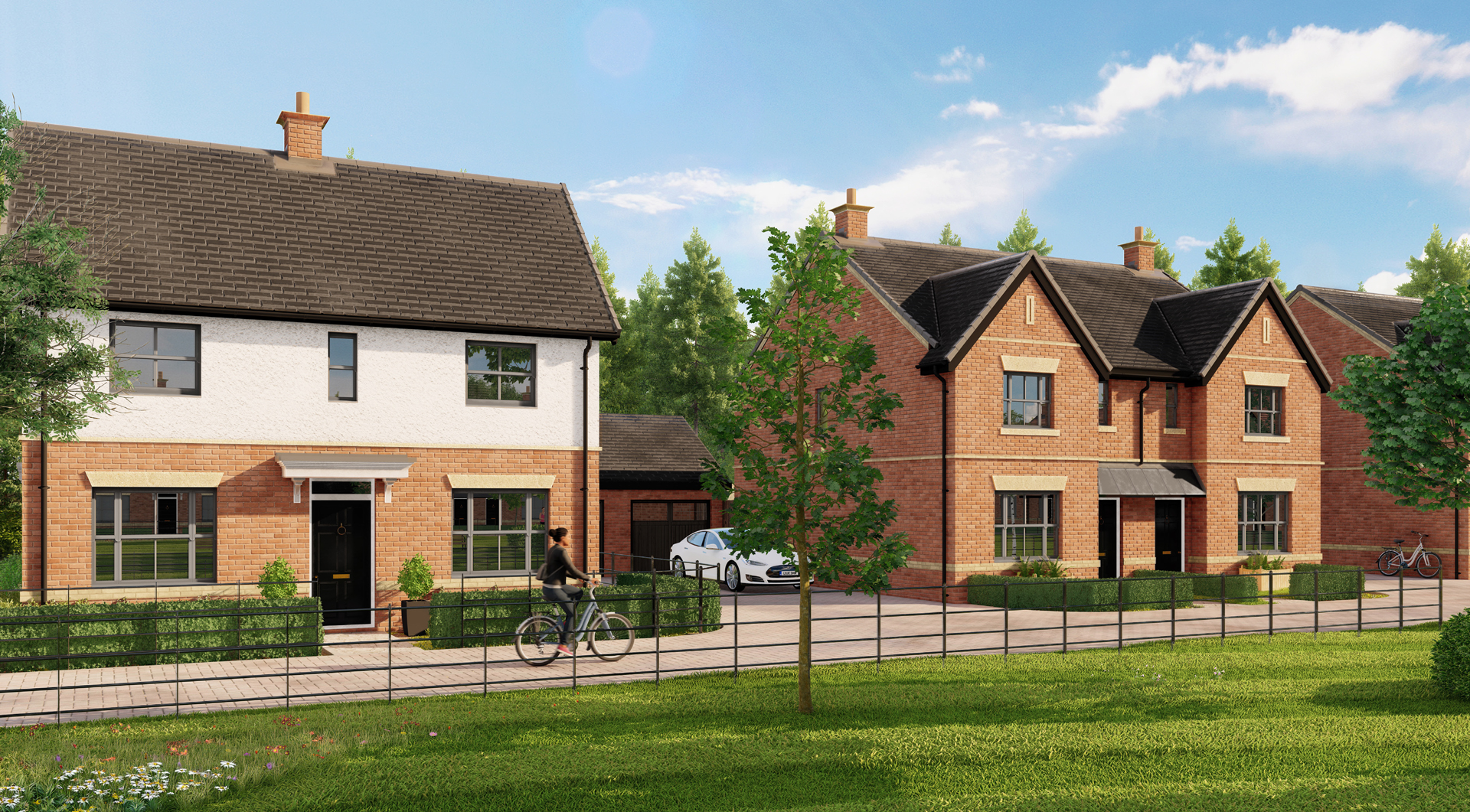
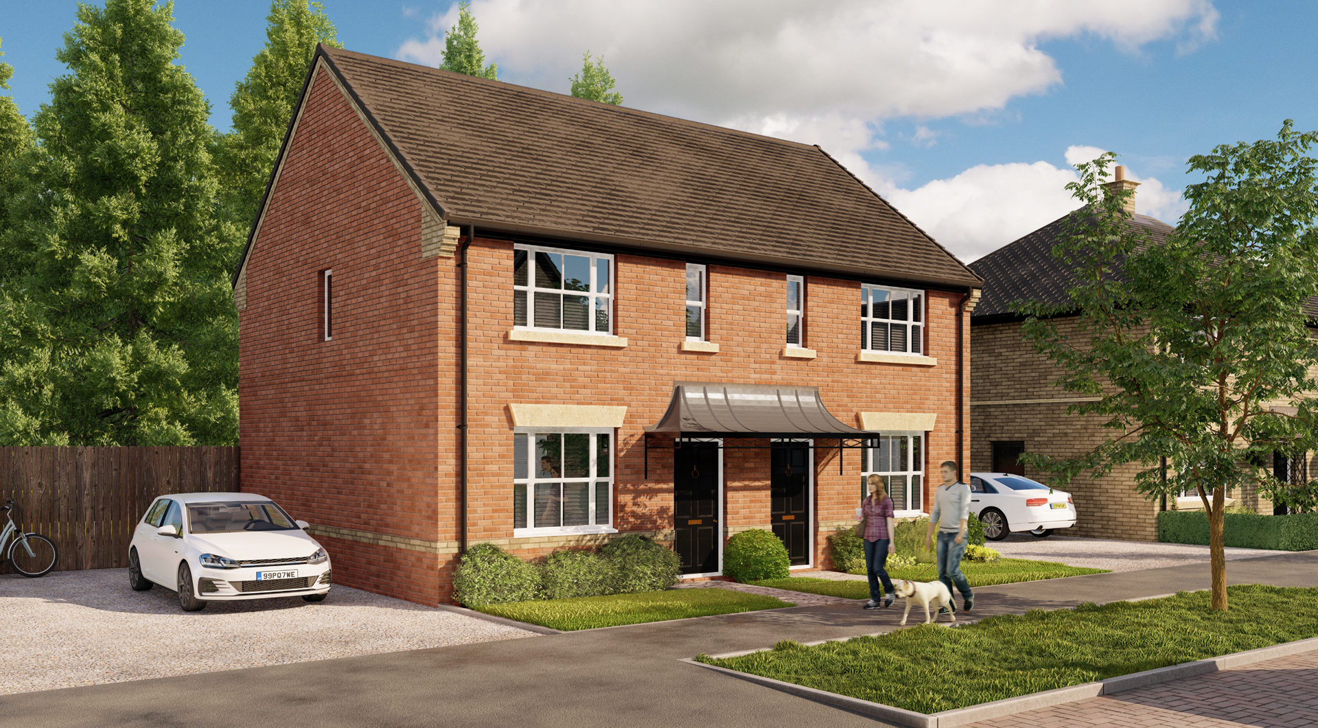
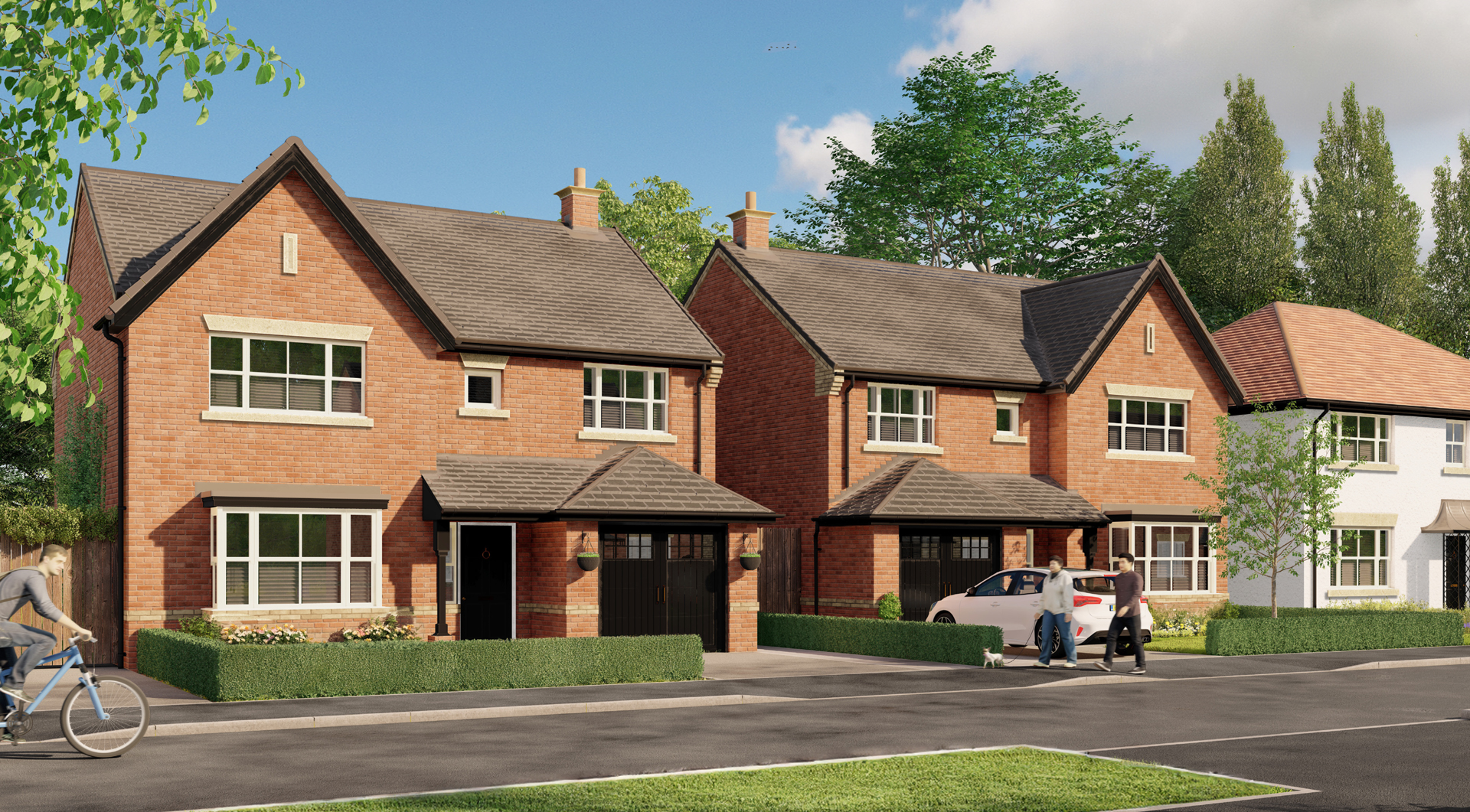
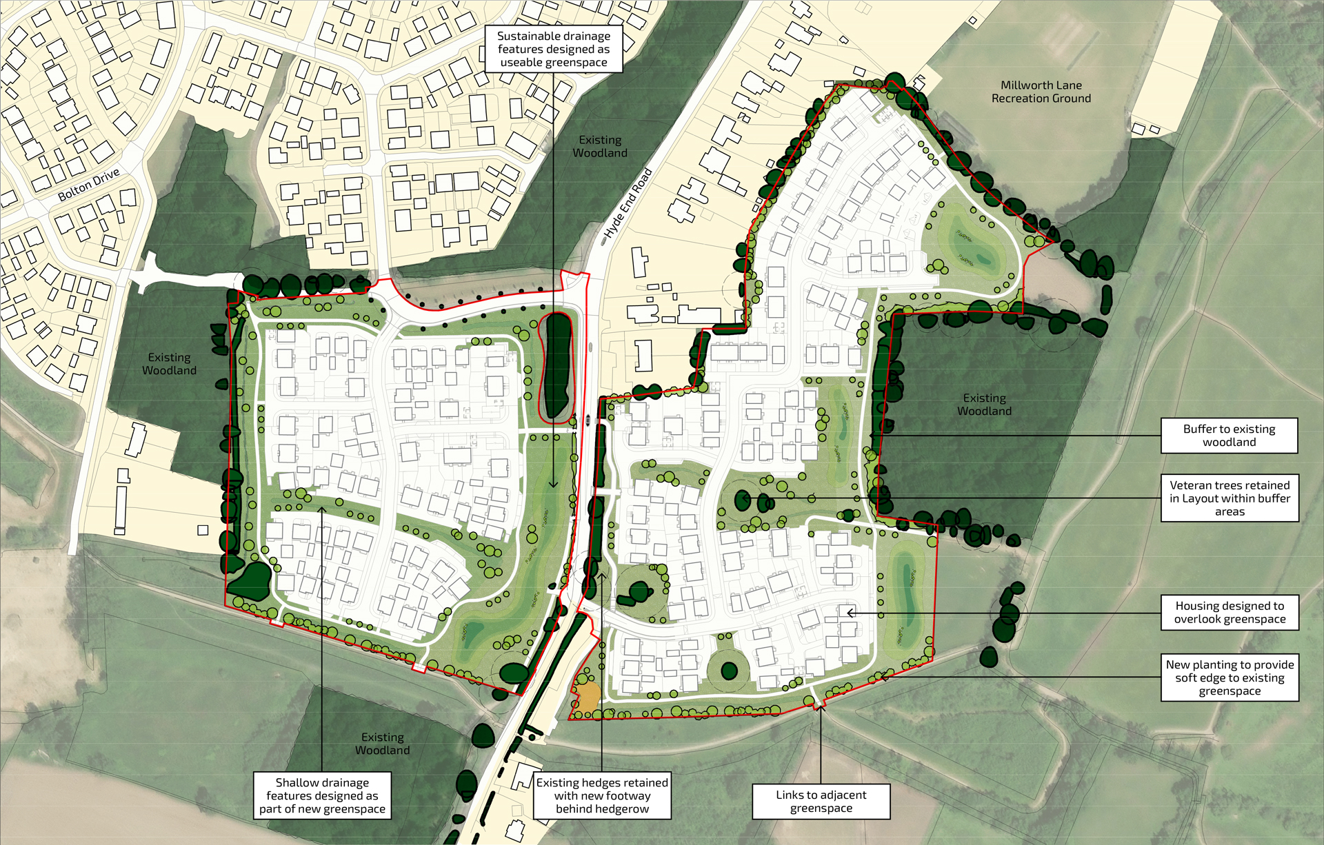
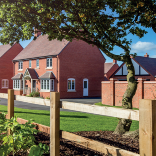
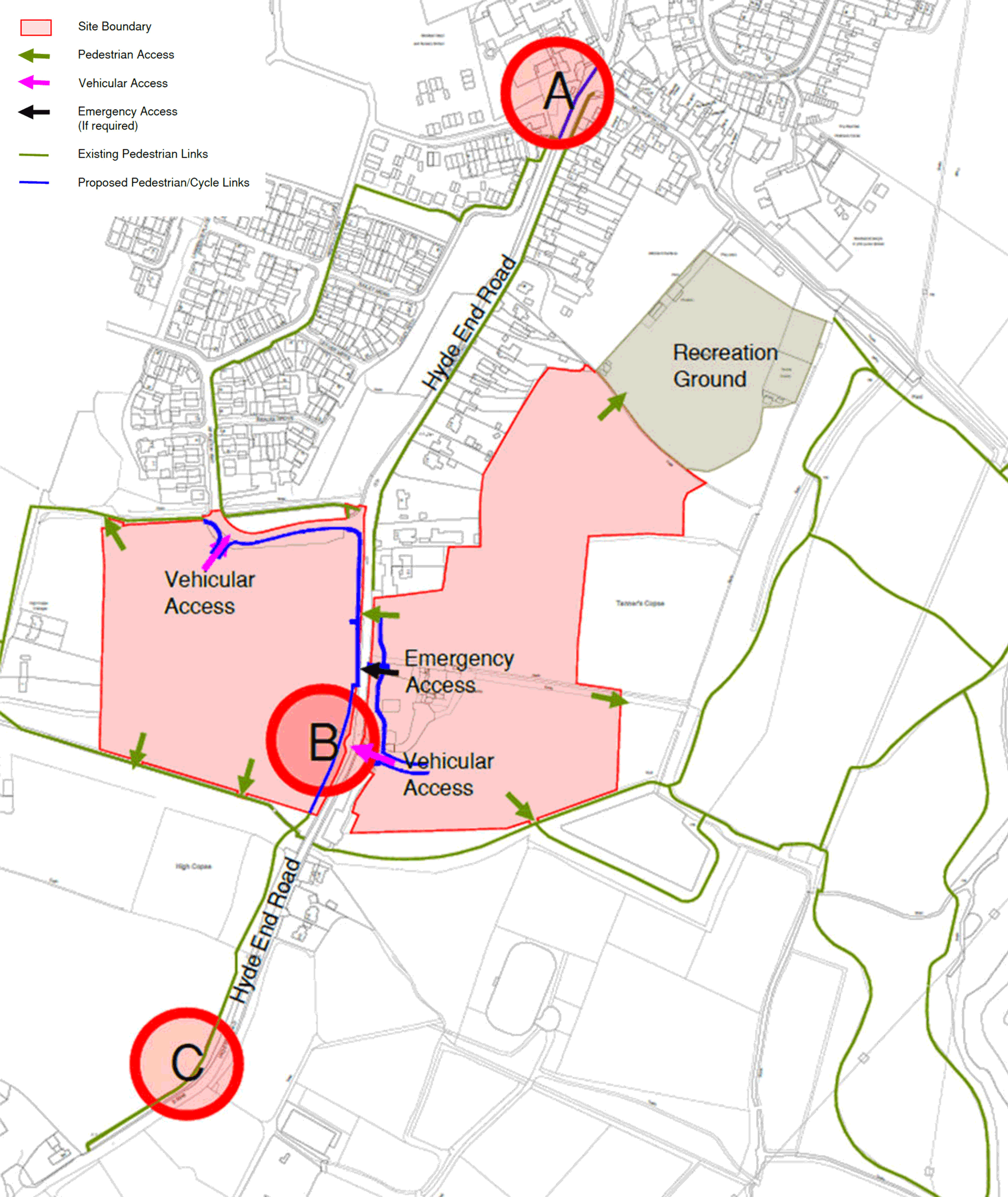
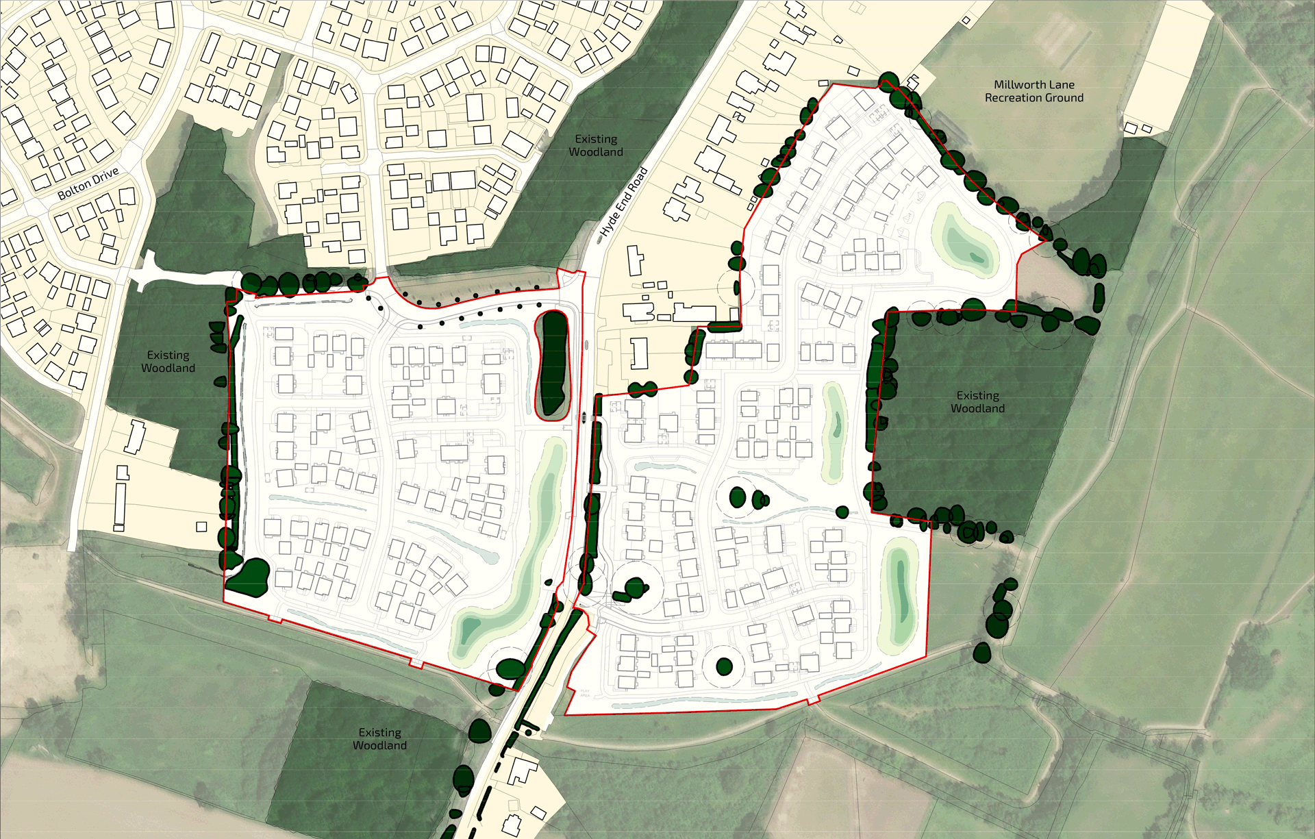
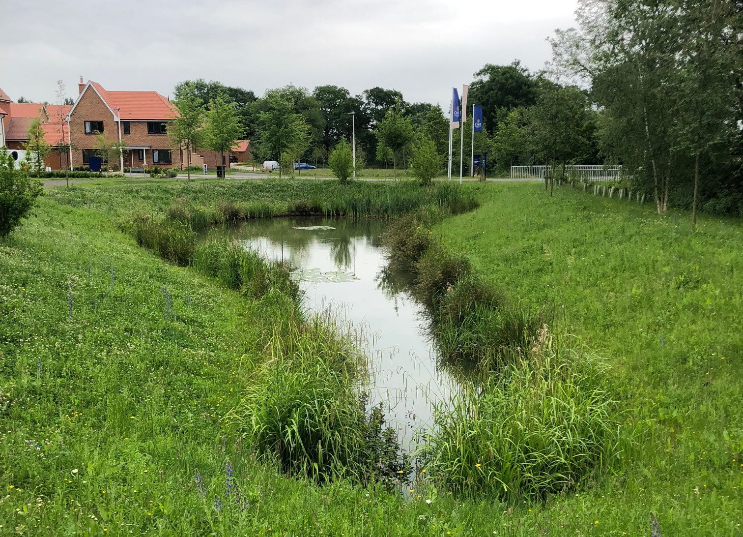
Our vision for the Land East and West of Hyde End Road is to provide a high quality, sustainable, and sensitively designed residential development that fits in with the character of the area, whilst providing a new edge to the built-up area of the village, in transition to the open countryside.

We recently consulted with the community and held an online public webinar with a Q&A session on Thursday 16th January 2025. We would like to thank everyone who has shown an interest in our proposals, asked us questions and shared their opinions with us. You can find information on the scheme we consulted on in the Emerging Proposals section and PDF copies of the consultation materials including a recording of the webinar is available in the Library section.

If you would like to receive email updates about this project, please sign up to our mailing list using the Register button below.

Location & Background

The site is situated to the southern edge of Shinfield and includes two parcels of land to the east and west of Hyde End Road.

Eastern Parcel

The eastern parcel is bounded by Hyde End Road and Langley Mead Car Park to the west, Langley Mead SANG to the south and east, with Millworth Lane Recreation Ground and allotments to the north.

Western Parcel

The western parcel is bounded to the north by Appleton Way and the Shinfield Meadows development further beyond, High Copse Farm to the west and a Public Right of Way (PRoW) footpath to the south which forms the SANG link into Langley Mead.

In total, the site is approximately 10 hectares (24.71 acres). The site has primarily been used as agricultural land and there are some existing agricultural farm buildings located on the eastern parcel.

Location plan showing the site boundary and two parcels to the east and west of Hyde End Road
Location plan showing the site boundary and two parcels to the east and west of Hyde End Road (Click to Enlarge)

Click the arrows below to scroll through the images:

  • Existing site photo showing Land West of Hyde End Road

    Existing site photo showing Land West of Hyde End Road

  • Existing site photo showing Land West of Hyde End Road

    Existing farm buildings on Land East of Hyde End Road

  • Existing site photo showing Land West of Hyde End Road

    Existing site photo showing Land East of Hyde End Road

  • Existing site photo showing Land West of Hyde End Road

    Existing site photo showing Land East of Hyde End Road

  • Existing site photo showing Land West of Hyde End Road

    Existing site photo showing Land West of Hyde End Road

Background

Bloor Homes

Bloor Homes was founded in 1969 by John Bloor and remains privately owned by the Bloor family. We have more than 50 years' experience building high-quality new homes across the country. We give thorough consideration to the communities in which we build to create beautiful places that provide a variety of new homes, while respecting local character, preserving natural amenities and protecting existing wildlife habitats wherever possible.

Bloor Homes has a longstanding relationship with the local community and the Parish Council and has a proven track record of delivering high-quality new homes in the local area, like Shinfield Meadows. We have taken the time to understand the unique characteristics of the site and are committed to creating a thriving community that we would love for ourselves, or our family and friends to live in.

You can find out more about Bloor Homes here >

Collage of bloor homes corporate images

94%

of our homeowners would recommend us

92%

of our homeowners are happy with the build quality of their new homes

90%

of our homeowners enjoyed our home buying process and experience

5-star Home Builders Federation rating for six years

A member of the Homes for Nature scheme

Rated Excellent on Trustpilot with over 3,500+ five-star reviews

Draft Wokingham Borough Council Local Plan

The draft Wokingham Local Plan (2023-2040) identifies the site for residential-led development under Policy SS14.12.

The proposed draft allocation allows for approximately 175 dwellings. The emerging Wokingham Local Plan is well advanced and is currently expected to be submitted for examination to the Secretary of State this year. The adoption of the new Local Plan is expected in 2026.

Wokingham Borough Council Draft Local Plan

Issues and Options Consultation

August 2016

Draft Local Plan Consultation

February 2020

Revised Growth Strategy Consultation

November 2021

Proposed Submission Plan Publication

September 2024

Submission

Early 2025

Examination

April 2025 - September 2025

Adoption

May 2026

Shinfield Neighbourhood Plan

Shinfield's Neighbourhood Plan was adopted in February 2017 to help Wokingham Borough Council decide planning applications in the Shinfield Neighbourhood Area.

The Neighbourhood Plan supports development adjacent to the settlement boundary limits where benefits of the development outweigh any adverse impacts.

Shinfield Parish Neighbourhood Plan

Key Development Priorities

We have three key development priorities that underpin our vision to create sustainable places, while respecting local character, preserving natural amenities and protecting existing wildlife habitats wherever possible.

Images of solar panels

Modern and Energy Efficient Homes

  • Reduce carbon emissions during construction and occupancy
  • Homes designed to improve energy efficiency and reduce energy bills for new residents
  • Prioritise low-carbon heating, combined with on-site energy production (solar panels)
  • Homes built to Future Homes Standards.
Images of wild planting

Landscape and Ecology Enhancements

  • Enhance and create planted areas with native plants, trees and shrubs throughout the site
  • Committed to Homes for Nature, a voluntary initiative to include a commitment to provide one bird-nesting brick for every new home built and hedgehog highways on all new developments
  • Protect Tanner's Copse with a buffer of enhanced planting
  • Both parcels of land will benefit from links to the existing Langley Mead SANG which provides opportunities for local visitors and residents to access open natural green space
  • Achieve 10% Biodiversity Net Gain, in accordance with Government requirements.
A family cycling

Active Travel and Sustainable Transport

  • The site is in a highly sustainable location with access to various public transport services that operate within the area, including within the Shinfield Meadows development area, located immediately to the north
  • Electric car charging points to be incorporated into the design
  • Encourage the use of bicycles, like shared routes within the site with clear connections to nearby cycle routes
  • Potential for off-site highways improvements to Hyde End Road, to improve safety for pedestrians and motorists
  • Encourage better pedestrian accessibility and connections including along Hyde End Road, to Millworth Lane Recreation Ground, Langley Mead and the neighbouring Public Right of Way.

Emerging Proposals

Our emerging masterplan shows how we think the new homes, access routes, and public open space could be delivered on the eastern and western parcels of land.

Our emerging masterplan showing layout of new homes, public open spaces, play area, and new pedestrian and cyclist connections
Our emerging masterplan showing layout of new homes, public open spaces, play area, and new pedestrian and cyclist connections (Click to Enlarge)

We are still in the early design stage but currently our initial plans could provide:

  • Up to 200 new homes, offering a range of dwelling types, sizes and tenures to help create an inclusive new community
  • Up to 70 affordable homes - 35% compliant with policy
  • Car parking spaces including reduced mobility and visitor spaces will comply with WBC's parking standards
  • Predominantly two storey, energy-efficient homes with low-carbon heating
  • Private gardens and amenity space for every home
  • Multi-functional public open spaces, recreational routes and a new area for children's play - accessible for existing and new residents
  • Sustainable Drainage Systems (SuDS) and flood alleviation features
  • Offsite highway improvements
  • Vehicular access off Hyde End Road and Appleton Way
  • A network of safe, attractive and direct cycle and pedestrian paths
  • Potential pedestrian connections to Millworth Lane Recreation Ground and Langley Mead
  • Enhancement of the existing Public Rights of Way (PRoW) network with new recreational routes within the site
  • Extensive planting of native wildflowers, trees, hedgerows and meadows
  • Retention of existing boundary vegetation including safeguarding any veteran trees and ancient woodland
  • Landscape buffers to protect the private amenity of existing and new residents
  • Homes built to Future Homes and Homes for Nature Standards
  • 10% Biodiversity Net Gain, in line with Government policy.
  • CGI showing typical feature square

    Typical Feature Square (click to enlarge)

  • CGI showing shared driveway

    Shared Driveway (click to enlarge)

  • CGI showing internal street

    Internal Street (click to enlarge)

  • CGI showing village street

    Village Street (click to enlarge)

Landscape and Ecology

Promoting healthy lifestyles and wellbeing through connection with nature are key drivers behind the landscape design.

Thoughtfully designed green open public spaces will be featured across the site. We are committed to providing biodiversity enhancements to achieve 10% Biodiversity Net Gain (BNG). BNG means that the site's natural environment would be in a better state than before by safeguarding and improving ecosystems.

Landscape Concept Plan
Landscape Plan (click to enlarge)

We are proposing approximately 4.18 hectares/10.33 acres of green open public space with the following features:

Images of solar panels

Enhanced Planting

Enhanced planting is proposed throughout the site, including on the eastern side around Tanner's Copse and on the western side between Hyde End Road and the new homes. Our landscape enhancements throughout the site would create new species-rich meadows with native hedgerows and wildflowers.

Images of wild planting

Children's Play Area

Subject to local needs, a 'natural' play area for children aged 0-12 years could be provided with play equipment and natural features, such as wooden climbing facilities.

A family cycling

Tree-lined Entrance and Streets

A tree-lined entrance to both eastern and western residential plots and tree-lined streets throughout the development are proposed. This new planting would promote biodiversity and create a welcoming and beautiful environment for new and existing residents alike.

Access and Transport

Access

Eastern Parcel: Access to the eastern parcel will be through the existing access which will be widened and paved to provide safe access for all vehicles. An emergency access point will also be provided.

Western Parcel: A new access point from Appleton Way is proposed, opposite the entrance to Shinfield Meadows.

Hyde End Road Improvements

We are exploring the potential to create an improved footpath for pedestrians along the western side of Hyde End Road (A). To help ensure road and pedestrian safety, offsite highway improvements are proposed on the bends between the parcels and just south of the site (B and C).

Pedestrian and Cycle Routes

  • Cycling and walking will be encouraged by providing new shared pedestrian/cycle routes throughout each parcel, to provide a safer alternative to Hyde End Road.
  • New recreational routes that connect into the existing Public Right of Way, with potential for additional links to Millworth Lane Recreation Ground, and Langley Mead.
  • Bicycle storage will be provided for each new home.

Public Transport Links

The closest bus stop Lawrence Place is located along Bolton drive at approximately five minutes walking distance from the site. PR600 route provides a connection as farthest as Reading town centre in the north and Riseley to the south via Spencers Wood. Other bus services such as 3 leopard, F52, 983 are available from the next closest stop at School green located along Hollow Lane north of the Site.

Frequency of services for 3 leopard are every 20 minutes serving Reading, Wokingham via Arborfield, Finchampstead. F52 services are match day services serving the Stadium via the Mereoak Park and Ride. The closest bus stop to the south of the Site along Hyde End Road is Croft Road served by PR600.

Parking

Each home will have access to car parking spaces and/or garages. The number of car parking spaces including reduced mobility and visitor spaces will be in full compliance with WBC's parking standards. Cycle parking will also be provided in line with the adopted standards, with adequate parking provided for both residents and visitors.

Access and Pedestrian Accessibility Context Plan
Access and Pedestrian Accessibility Context Plan (click to enlarge)
Image of man teaching a boy to ride a bike

Drainage

Surface water drainage

  • Surface water disposal will be managed through Sustainable Drainage Systems (SuDS) that will mimic the site's existing, pre-development response to rainfall. SuDS include a system of ponds and basins that retain rainwater on the site to minimize flood risk
  • SuDS features will be designed to accommodate the design rainfall event (i.e. the 1 in 100-year event with an additional 40% allowance for climate change) to ensure flood risk will not increase either on-site or elsewhere because of the development
  • Sufficient space for SuDS will be provided within the proposed masterplan
  • Control measures to prevent pollution of these ponds and basins will be provided as part of our SuDS strategy.

Foul water drainage

It is proposed that the new homes will be connected to the mains drainage network. There will be no difficulty in connecting the new development to the existing foul water infrastructure.

Drainage Features Location Plan
Drainage Features Location Plan (click to enlarge)
Indicative image of proposed drainage feature
Illustrative Example of a SuDS feature

Sustainability

Our high sustainability standards ensure that the new homes and spaces we build today are fit for the future.

We will aim to achieve this through:

  • A fabric first approach for new homes that uses high-performance and efficient building materials to reduce energy consumption and costs for new residents
  • Building water and energy-efficient homes that include low and zero carbon technology e.g. solar panels
  • Provision of waste and recycling storage
  • Inclusion of secure cycle storage and cycle routes, to encourage alternative modes of travel
  • Responsible sourcing of materials
  • Minimising surface water run-off and provision of Sustainable Drainage Systems (SuDS)
  • Management of waste sustainably and efficiently during construction
  • Biodiversity enhancements to achieve 10% Biodiversity Net Gain (BNG) through new planting and habitat enhancement throughout the site.
Images of car charging, cycle storage, solar panels and a bee visiting flowers

Have Your Say

Our public consultation has now closed.

We are currently reviewing your feedback and will be sharing it with the project team, who will be considering the feedback received as they work towards developing the final scheme to be submitted as a planning application to Wokingham Borough Council, in due course.

When our planning application has been submitted and registered by the Council, there will be another chance for you to have your say on our final scheme. We will update this website and provide information on how you can access the application documents and submit your comments online.

If you haven’t already signed up for updates and would like to be kept up to date with our progress, please leave us your contact details through the feedback form or register below.

Register

Q&A

As with any new development, there are often lots of questions raised by the community. We will continue to add your questions and our responses that arise during our consultation in this section.

The Land East and West of Hyde End Road is a draft allocation in the emerging Wokingham Borough Local Plan and is considered a suitable site for sustainable growth and development. Bloor Homes are bringing forward these development proposals to respond to the site's draft allocation and to deliver much needed new homes in Wokingham.

We are proposing to build up to 200 new homes, including up to 70 new affordable homes.

We are proposing a mix of one- to four-bedroom homes with most homes being two-storeys tall.

The eastern parcel will be accessed by vehicles through the existing access off the car park for Langley Mead, and the western parcel will be accessed by vehicles through a new access point off Appleton Way, opposite the entrance to Shinfield Meadows. New pedestrian and cycle connections are proposed along Hyde End Road, and we are exploring opportunities to provide pedestrian connections to Millworth Lane Recreation Ground, Langley Mead, and the Public Right of Way.

Car parking spaces including reduced mobility and visitor spaces will comply with WBC's parking standards, including electric vehicle charging provision.

We are exploring the potential to create a new footpath link at Hyde End Road on the western side of Hyde End Road south of School Green. To help ensure road and pedestrian safety, carriageway widening is proposed on the bends between the parcels and just south of the site.

Contributions to offset any potential impact on local services and facilities will be provided as part of the Section 106 agreement with Wokingham Borough Council. The exact amount and recipients of S106 funding will be determined at a later date, further along in the planning process.

Our proposals will deliver a 10% BNG through protecting existing habitats and delivering enhanced planting throughout the site, including wildflower meadows, hedgerows and green open space. New wetland ponds will also be introduced as part of our Sustainable Drainage Systems, which will contribute to BNG as well. Trees will be retained as much as possible and protected by setting any new development well back from tree root protection zones, and with new planting to complement existing trees where possible.

As the developer, we have an obligation to produce a Construction Management Plan, which will be submitted alongside other documents when we submit our planning application. This document outlines how the construction process will be managed and will stipulate the specific times and routes construction vehicles are allowed to enter and leave the site. We will use the strategic network as far as possible to limit any impact on the local roads and residents.

We are aiming to submit our planning application in early spring, and we expect a decision later this year. If permission is granted, works could start on site in mid-2026. These dates are indicative only and are subject to change as the planning and design process progresses.

The site is located within Flood Zone 1, which is the lowest risk for flooding and most suitable Zone for any type of potential development. Through Sustainable Drainage Systems, a series of swales and basins will collect and manage surface water drainage throughout the site.

While south-facing roofs are ideal for solar panels in the UK, east-west roofs can still be very effective, particularly when there is a need for more even energy production throughout the day. With modern solar technology and the UK's typically cloudy climate, east-west installations can provide a reliable source of solar energy.

From a design perspective, it wouldn’t be best practice to design a layout based on the orientation of roofs. There may however be opportunities to utilise more hipped roofs which would introduce more south facing roof slopes.

The development parcels to the east and west of Hyde End Road benefit from being positioned alongside two highway corridors. This offers the opportunity to create separate points of access for each parcel which will lessen the amount of traffic directly accessing onto Hyde End Road and hence achieve better dispersal of flows along the surrounding road network.

The use of a new four arm roundabout onto Hyde End Road was however evaluated as part of the early optioneering process. The arrangement considered was akin to that which was promoted at the Deer Leap Park development at Three Mile Cross (where the lack of secondary highway corridor prevented any alternative arrangement). However, it became apparent that the provision of a new roundabout would lead to vegetation loss along the corridor as well as negative impacts on the root and buffer zones of the veteran trees which are located on both sides of Hyde End Road in the vicinity of the existing access to Langley SANG Car Park. The proposed configuration of two separate access points avoids these negative impacts and hence has been progressed as the preferred option. At this stage it is anticipated that the separate access junctions will both operate well within capacity with minimal queuing in the peak hours, albeit this is a matter that will be tested in detail within the Transport Assessment Report that will accompany the forthcoming planning application.

The development introduces new SuDS features to cater for new surface water generated by the proposals. This will ensure that surface water runoff is passed to existing watercourses at a controlled rate. As part of the technical assessments, a comprehensive surface water hydraulic model has been created in order to understand how recent development at Shinfield Meadows may influence the proposals. This work is ongoing and will form part of the application package.

Flooding within Langley Mead is due to high water levels within the River Loddon and its tributaries, as opposed to runoff from the upstream catchments. However, the imposition of new SuDS features within the scheme will assist.

We started taking Wildlife Surveys on the sites, in July 2024 and they are continuing this year. Once we have all the surveys complete, we will be able to give a more detailed response. Regarding the barn owls, we will look to manage the grassland areas to make sure they get the litter lay they need for their foraging which will enhance the site as currently the areas that are suitable are minimal. We will enhance the hedgerows and tree lines on site which will enhance nesting opportunities for birds as well as the artificial bat and bird boxes, and hedgehog highways which will account for a lot of the species that are there currently.

We are proposing to build up to 200 homes including up to 70 affordable homes (35% policy compliant).

We have undertaken scoping discussions with Wokingham Borough Council to agree a methodology and approach that we will be undertaking when appraising the impact of the development that includes using their approved trip rates and have run the analysis within Wokingham Borough Councils approved traffic model. We are currently working through the findings and the work to assess the traffic impact is well underway. Early findings show that the two points of access, as proposed would operate within capacity for the peak hour periods and the analysis for the junctions further afield is currently being assessed.

We have had a meeting with officers at Wokingham Borough Council and there will be a requirement for some play facilities on the site so they are close enough to the new homes but as for the extent, type and location in the development, we have not yet got to that level, however it is envisaged that such play space would be integrated within the green spaces, so it might be that natural play facilities are provided, rather than formal swings and slides.

Unfortunately, real chimneys are not an option these days due to being inefficient and unsustainable, so in this case they will be for aesthetic purposes to break up the ridge line and to add interest and character to the houses and street scenes.

The images we have shared are for illustrative purposes only, but the new homes will have solar panels, positioned to maximise solar gain.

It is impossible to give an exact price range of these homes at the current time. However, when the homes come forward, they will be comparable in price to new build properties within the local the area.

No, the Dobbies site is further South nearer to Spencers Wood.

We are very aware of the proposals for Millworth Recreation Ground, and we are looking to ensure our development and what we are proposing on our common boundary is compatible with respect to the specific nature of what is being proposed. We are exploring the opportunity to try and get a pedestrian connection through to the recreational ground and will be discussing this both with Wokingham Borough Council and Shinfield Parish Council moving forward.

This is guaranteed. There will be a minimum of 35% affordable homes on the site which is compliant with the requirements of Wokingham Borough Council's Development Plan.

The approach that Wokingham Borough Council take is to seek further financial contributions from developments towards the ongoing provision of services like the 600 and as development becomes built out look for opportunities to increase the provision. Such a contribution is anticipated to help sustain the bus service in the longer term.

Yes, every home will have EV charging points installed.

This is still to be discussed with Wokingham Borough Council, but there will be a package of contributions towards the delivery of local infrastructure. Some of those elements will be through the direct provision of infrastructure on the site itself and the S106 Agreement would secure that. There might also be financial contributions towards other infrastructure items and those all need to be discussed with Wokingham Borough Council and agreed in due course. This is something that will be done as we get closer to the submission of the Planning Application and indeed once the Planning Application is formerly lodged, that will form part of the consideration at that time. The development will also generate millions of pounds towards local infrastructure through Community Infrastructure Levy (CIL) contributions, up to 25% of which will be managed Shinfield Parish Council.

As a minimum it is proposed that the gardens will generally be a minimum of 10.5m in length to the back of resident's garden fence. However, where required, these will be increased to ensure no unacceptable impacts are caused in respect of overlooking or privacy.

We are currently proposing 3 bungalows and 11 ground floor maisonette's which are built to M4(3) standard (accessible). As we are building to 'Future Home Standards' all the other homes on the site will be to M4(2) standard (adaptable) which is a higher level than standard building regulations and the homes can be adapted to become wheelchair friendly. This also includes a car parking space that can be increased to 3.3m wide.

We are working with Thames Water, as the local sewage provider to ensure that suitable mains drainage is available and where not, can be provided through upgrade works.

We are looking to submit our Planning Application within the next 2-4 months and following the grant of planning permission, a start of site will follow soon afterwards, which is anticipated for spring/summer 2026. The delivery of this development is likely to take 2-3 years.

The affordable housing provision will be pepper potted (scattered) throughout the development and will be 'tenure blind' meaning that the affordable housing does not look any different to the other housing on the site to ensure we create an inclusive community.

We are very familiar with the position and location of schools and Doctors surgery that are within the village and within easy working distance from the site. We are aware of the extent of them being well used and we will be discussing in a lot of detail with Wokingham Borough Council the local infrastructure requirements arising from this development. We will look at this very carefully regarding any impact from the development and how it is addressed in terms of delivery of infrastructure.

Yes, to meet the Future Homes Standards the development is likely to provide air source heat pumps to meet the heating needs of the new properties, alongside Solar Panels for renewable energy generation. The exact details for each individual dwelling will however be determined at the detailed design stage as part of the Building Regulation requirements.

No there is still a significant swathe of land that will remain, and we are looking carefully at the landscape and the visual envelope of the development and its wider context. We have the benefit of the series of elements of the existing woodland which helps to create the context and backdrop to the development but there is still significant land that will exist between Shinfield, as it would become with this development added to it, and Spencers Wood. We are satisfied that the significant land which will remain undeveloped.

It is too early at this stage to have details of the build programme. In terms of phasing we anticipate that it will all be built in one go as due to the size of the development it would not need to be built out in distinct phases.

We are currently in discussions with Wokingham Borough Council as to whether or not they would be willing to adopt open space provision and the sustainable drainage network, but if not, then the likelihood is that it will be looked after by a Management Company which will eventually be run by the residents themselves. However, nothing has been agreed at the moment as we are still in the early stages, and this is forming part of the process of evolving the plans. It is likely that the roads, paths and other such highway infrastructure will be adopted by the Council, as per Bloor Homes standard preference.

In response to comments from the Local Planning Authority and the Urban Design Officer, we are aiming to minimize this distance by reconfiguring the road to run adjacent to the boundary. This change will help increase the separation between the existing and proposed houses. While some backing onto existing properties will be retained, it will be significantly reduced. We will ensure a minimum of 10.5m back gardens for these properties or a separation of 22m to the rear of the existing houses, whichever is greater, to safeguard the amenity of current residents.

We are not currently proposing any three-storey units on the site. The term "predominantly two-storey" is used because the site also includes some single-storey bungalows.

The precise nature of any off-site highway improvements is a matter that will be discussed and agreed with Wokingham Borough Council during the course of the determination period for the planning application. At this stage however, the potential works along Hyde End Road that have been identified include carriageway widening at the two bends to the south of the development parcels and a new pedestrian crossing (with central refuge island) located between the frontages of the two parcels. The scope for improving pedestrian connectivity in the vicinity of Shinfield Primary School is also being investigated. The precise timescales for the implementation of any works is again a matter that will be agreed with Wokingham Borough Council. Notwithstanding, at this stage it is anticipated that such improvements would be implemented early during the build out trajectory.

At this stage it is not anticipated that the off-site highway mitigation will encompass traffic calming features along Hyde End Road, other than perhaps at the pedestrian cycle crossing that is being promoted at the frontage of the development parcels. This however is a matter that will be reviewed as the traffic impact of the development is appraised in full within the Transport Assessment Report that is being prepared to accompany the forthcoming planning application.

Excess surface water runoff is known to pass from west to east following existing land falls towards Hyde End Road. As part of the development proposals, such surface water runoff routing needs to be considered and mitigated. The introduction of a positive drainage network and associated sustainable drainage features with help to reduce any overland flow routes.

The existing woodland will be protected with additional buffer planting within the site. No public access will be provided, so the woodland will be protected. The buffer zones provided adjacent to the woodlands are compliant with the Natural England and Forestry Commission Standing Advice and shall be planted as a semi-natural habitat.

Timeline

Throughout the pre-application planning programme, we will be in ongoing discussions with planning officers and stakeholders about our emerging proposals to develop the site. The timings set out below are indicative dates and will be subject to change as we progress through the design and planning process.

  • Thursday 16 January 2025 Live public webinar with Q&A session and launch of consultation period
  • Friday 31 January 2025 Deadline for comments. Consultation period closes at midnight
  • Early Spring 2025 Submission of planning application to Wokingham Borough Council
  • Late Summer 2025 Expected determination of planning application by Wokingham Borough Council
  • Mid 2026 Works to start on site, subject to planning permission being granted

Dates are indicative only and will be subject to change

Library

Contact

If you have any comments or questions or would like a hard copy of any of our consultation materials, please contact us.

Send us a message and we will get back to you as soon as we can:

landathydeendroad@stantec.com

By Phone

If you want to chat to a member of the team, give us a call:

0207 446 6837
(Monday to Friday – 9.30am to 5pm)

004-pencil

By Post

If you would prefer to put pen to paper:

Land at Hyde End Road Community Engagement Team
C/O Stantec, 7 Soho Square
London, W1D 3QB